Maps auctions
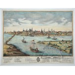
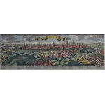
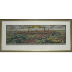
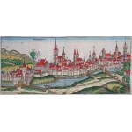
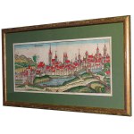
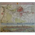
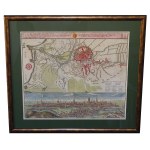
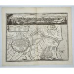
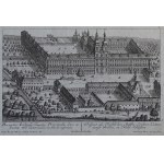
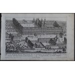
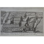
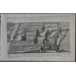
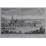
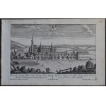
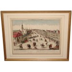
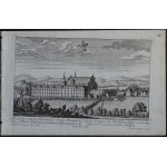
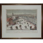
(WARSAW) - "Varsovie, Ville Capitale de la Pologne. Warschau, die Haupt-Stadt in Polen". Copperplate hand-colored in period; G. B. Probst. 18th century (Signed: Georg Balthasar Probst excud. Aug. V.). Dimensions: 30 x 40 cm (board: 32 x 41.5 cm.).Panorama of Warsaw as seen from the other side of the Vistula River. Below the view, explanations of the more important buildings in French and Germa...
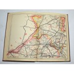
Postal and communications ATLAS of the Rzpl. Poland. Warsaw b.r. Nakł. Inst. Kartograficzny "Gea". 8, p. [2], 1 map - (Skorowidz...), XXI color folding maps. and:- Supplement to the map and postal-communication atlas in the scale 1:800,000. n.d. Warsaw. Nakł. Tow. Kartog.-Wyd. "Gea". 8, pp. 102, [2], publisher's fawn binding.Unwarranted rubbing and dustiness of binding. Good condition. The a...
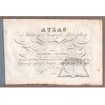
(Atlas). LELEWEL Joachim - Atlas for ancient history and geography. According to the plan of ... a member of many learned Societies, recommended for use to schools and scientific Institutes: by the Government Commission for Public Enlightenment. Made and published at the School Lithographic Institute in Warsaw 1828. 23.5 x 36 cm, 15 pages in lithography (including title page and 14 line-color ...
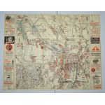
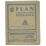
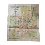
(POZNAŃ). Plan of the capital city of Poznan. Poznan b.r. Nakł. Bookstore Wydawnicza Spółdz. "Pomoc. Color map, folding, size 52 x 67 cm.Very good condition.
ATLAS von Europa in zwein und achtzig blatterrn von F. W. Streit. Berlin 1837. 4 podł., p. [4], among 82 color maps missing no: 7, 41, 61, 68-71, 79-81, cloth binding contemporary with gilt on spine.Traces of stains and browning of maps. On p. tit. ownership entries.
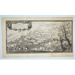
(Dahlberg). (SANDOMIERZ. Swedes and Lithuanians). "Conflictus inter Svecos et Lithuanos dimidio ab Urbe Sandomiria milliari...". J.E. Dahlberg. Nuremberg 1697. copperplate. Board format: 36.5 x 58 cm.Depicts military actions near Sandomierz in the forks of the Vistula and San rivers. On one side the Swedes of Charles Gustav, while on the other side the Lithuanian army led by Pawel Sapieha and ...
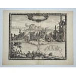
(Dahlberg). (ZŁOTÓW and Drawsko Stare). "Flatou Pomerelliae Arx dificillimi accessus...". J. E. Dahlberg. Nuremberg 1697. copperplate. Format: 36.5 x 41 cm. Depicts at the top the castle of Zloty fired by the Swedes. At the bottom a projection of Drawsko castle among the waters of the lake. Engraving from the work of Samuel Pufendorf. Good condition. A strong print. Unw. traces of yellowing ...
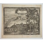
(Dahlberg). (ZAWICHOST). "Prospectus Oppidi Savichost...". J.E. Dahlberg. Nuremberg 1696. copperplate. Format: 29 x 38 cm, (board: 35 x 42 cm). Signed "E. I. Dahlberg. Supr: Castr: metat: delin.".Rakoczy with his troops forcing the Vistula River near Zawichost. Expanded landscape and compact groups of troops crossing the Vistula at the ford. Engraving from the work of Samuel Pufendorf. Traces ...
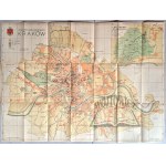
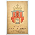
(KRAKOW). New Plan of the City of Cracow Plan of the Wolski Forest - Directory of streets - Information section. Cracow (b. r.) Publisher of the Salon of Polish Painters. Druk "Akropol". 8, p. [4], plan size: 54.2 x 74 cm. Plan in color, prepared by Adam Launer. Condition of the plan good, soiling and non. rubbing of the cover.
sheet approx. 31 by 23.5 cm
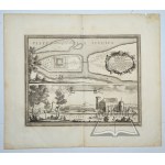
(Dahlberg). (WYECIE near Danzig). "Ichonographia Castri Schwetz". J. E. Dahlberg. Nuremberg 1696. bipartite copperplate. Format: 26 x 31.5 cm. Depicts a plan and view of a castle occupied by the Swedes. The castle on a river island flanked, by the waters of the Vistula and Wda rivers. Engraving from the work of Samuel Pufendorf. Good condition.
View of Danzig "DANTZIG" Heirs of Jeremias Wolff, 1724 impressive, representative panorama of Gdansk including frame approx. 118.5 by 55 cm
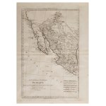
Engraved map of Mexico and Central America Historical map with toponyms and boundaries 40x30 cm
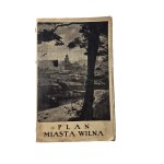
City plan of Vilnius, published by Jozef Zawadzki printing house and bookstore, Vilnius 1937, scale 1:12.500, Zakłady Graficzne "Biblioteka Polska" in Bydgoszcz, on the back index of the most important buildings, list of streets, f. 53x64cm traces of stains on edges, on back glued with paper in places of folding, otherwise good condition
in a binding approx. 70 by 42 cm paper with traces of age - stains, undercoating
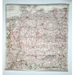
(WWII escape map). Central Europe. Scale 1:2,000,000. Dimensions: 51.5 x 47.5 cm.Condition b. good. The map was owned by Antoni Tomiczek (1915-2013), who was a Polish military pilot and World War II veteran, known primarily for his airdrop flights over occupied Poland, including over Warsaw during the 1944 uprising. After the war, he returned to his homeland and lived in Silesia, and his heroi...
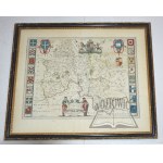
(OXFORDSHIRE). Oxonium Comitatus, vulgo Oxford Shire. Copperplate color. Amsterdam ca. 1645; Joan Blaeu. Dimensions in light frame: 48 x 58 cm, (in frame behind glass: 54.5 x 64.5 cm).Two-page map of the county of Oxford on the Thames. Extremely decorative map with figural title cartouche (two scholars). Royal coat of arms and sixteen other college coats of arms along both sides of the map. Th...
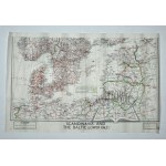
(WWII escape MAP). Northern Europe (Baltic Sea basin). "Scandinavia and The Baltic (lower half)". Scale 1:3,000,000. dimensions: 36 x 56 cm.Condition b. good. The map was owned by Antoni Tomiczek (1915-2013), who was a Polish military pilot and World War II veteran, known primarily for his airdrop flights over occupied Poland, including over Warsaw during the 1944 uprising. After the war, he r...
(Dahlberg). (GDAŃSK). Dantiscum. J.E. Dahlberg. Nuremberg 1697. bipartite copperplate. Signed "De La pointe sculp." Board format: 36.5 x 41 cm.In the upper part a perspective view of the city. Bottom bird's-eye view, topography of suburbs and surroundings with Vistula estuary and fortress. Between city panorama and plan, legend with list of 30 important monuments of the city. Good condition. ...
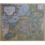
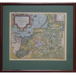
Map of Prussia "Prussiae Regionis Sarmatiae Europeae nobiliss. vera et nova descriptio auctore Gasparo Hennebergero Erlichensi Pastore Mulhausensi. Privilegio decennali 1584"
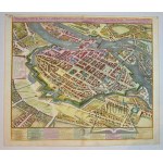
(WROCŁAW). Ichnographica Urbis Wratislaviensis Delineatio, Praeter Alia Exactissime Etiam Repraesentans Singula Templa et Monasteria . . . 1752 Copperplate color. Homann Heredibus. Nuremberg 1752. dimensions: 48.5 x 55.5 cm (board: 51.5 x 61 cm).Carefully executed plan / bird's eye view of Breslau. City streets, buildings, fortifications and surrounding countryside are depicted in great detai...
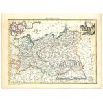
(POLAND, Duchy of Warsaw). G(rand) Duche de Varsovie; Prusse. Color copperplate. At bottom signed Grave par Chamouin (engraver); Ecrit par Aubert (author) fils. (Paris ca. 1812). Format: 21.8 x 29.8 cm (board: 25.5 x 33.5 cm)Good condition. In upper right corner a Polish lancer on horseback with a banner. The Duchy of Warsaw existed between 1807 and 1815, so the map is a testimony to the geopo...
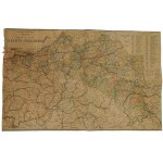
(LITHUANIA, Belarus). "Vilkomierz, Dvinsk, Vilna, Vileyka, Slonim, Minsk. Generalstabes der Armee. (Berlin) 1916. scale: 1:300,000. dimensions: 123 x 93 cm.Folding map of large size with extremely rich topographical nomenclature. Good condition.
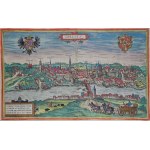
Zgorzelec "GORLITZ" "Gorlitium, Urbs Superioris Lusatiae, ad vivum delineata, Anno Salutis MDLXXV" Georg Braun, Frans Hogenberg "Civitates Orbis Terrarum" 1575
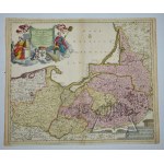
(northern POLAND). "Ducatus Prussiae tam Polono Regiae...". Copperplate color. Justus Danckerts. Amsterdam ca. 1696. Format: 49.3 x 58.5 (board: 51 x 61.5 cm).Good condition. Map included in Cornelius Danckerts' atlas at the end of the 17th century, and compiled by Justus Danckerts. Richly decorated information cartouche with the coat of arms of Prussia in the upper left corner; scale in the l...
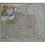
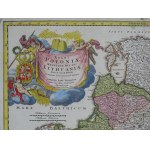
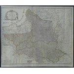
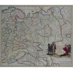
Map of the lands of the Republic of Poland "Regni Poloniae Magni Ducat Lithuaniae...".
(GALICIA). "Carte de la Pologne Autrichienne contenant La Russie Rouge et la partie meridionale du Palatinat de Cracovie, etc.". Copperplate. color. linear. Drefsee sur l'Exemplaire des Heritiers Homan 1775. a Venise par P. Santini 1776. chez M. Remondini. (Venice 1776). Format: 44.5 x 59 cm (board: 52 x 75.5 cm).Traces of dampstain. good condition. Title in decorative cartouche in lower left ...
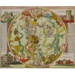
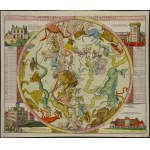
Map of the sky - southern hemisphere illustrations in the corners depicting astronomical observatories in Greenwich, Copenhagen, Kassel and Berlin Johann Gabriel Doppelmayr, published by Homann ca. 1730
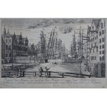
Gdansk View of the Motlawa River from the Kuh-Thor-Brücke towards the Fish Market "Prospect der Mottau von der Kuh-Thor-Brücke bis nach dem Fisch-marckt Mottlaviae e ponte iuxta portam vaccinam sito usqve ad forum piscarium Prospectus" Matthäus Deisch 1765 plate 38 from the series "50 Prospecte von Danzig" sheet approx. 30 by 21 cm
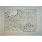
(POLAND). "Carte de l'ancien Royaume de Pologne : partagé entre la Russie, la Prusse l'Autriche".
516 EUR
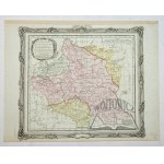
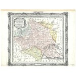
(POLAND). "Carte de l'ancien Royaume de Pologne : partagé entre la Russie, la Prusse l'Autriche". Par les traités successiss de 1772, 1793, et 1795 : contenant aussi, le Royaume de Prusse / par E. Mentelle, Membre de l'Institut Nationale et P.G. Chanlaire, l'un des Auteurs de l'Atlas National.Line-colored copperplate. Mentelle, Edme (1730-1815) Author, publisher. Chanlaire, Pierre-Gilles (17...
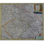
Bohemia Silesia Moravia "Regni Bohemiae, Ducatus Silesiae et Marchionatus Moraviae" Funck 1695
178 EUR
Map of Bohemia, Silesia and Moravia "Regni Bohemiae, Ducatus Silesiae et Marchionatus Moraviae...". David Funck, Nuremberg 1695 sheet approx. 62 by 54 cm
Historical atlas for ancient, medieval and modern history for the use of the higher and secondary scientific establishments of Austria-Hungary. Published by Alfred Baldamus and Ernest Schwabe. Contains 52 large and 61 smaller maps. Polish edition compiled by. J. Lewicki and Wł. Bojarski. 2nd ed. Vienna 1908. ed. by Nakł. A Pilcher's Widow and Son. 8 (large), pp. X, color maps. 32, cloth bind...
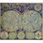
Astronomy, constellations, sky map "PLNANISPHAERIUM COELESTE" Johann Michael Probst 1780 framed approx. 75 by 68 cm
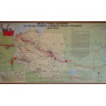
Places of National Remembrance on the combat route of the People's Army of Poland 1943-1945 Swiecicki, Zielak 1978 ca. 172 by 100 cm. at bottom and top wooden shafts
(ŻAGAŃ). "Principatus Silesiae Saganensis in suos circulos Sagan Priebus et Naumburg divisi et ...".
282 EUR
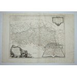
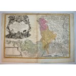
(ŻAGAŃ). "Principatus Silesiae Saganensis in suos circulos Sagan Priebus et Naumburg divisi et ...". Color copperplate. 1736. comes from the atlas: Homannianis Heredibus - Atlas Silesiae .... Nürnberggae 1752. according to Schubarth and Wieland. Format: 62.5 x 91 cm. Traces of dampstaining and browning, edges slightly creased with some tears, fold marks. A large information cartouche in the...
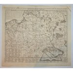
(POLAND). "Nouvelle carte du Royaume de Pologne, divisee selon ses palatinats et ses provinces, ...". Copperplate. The map comes from H. A. Chatelain - "Atlas historique...", T. 1 - 4, was published between 1705 and 1739 in Amsterdam and Paris. Format: 50 x 57,7 cm (board: 56 x 63,5 cm). Good condition. Title lettered above the upper frame of the map. Map compiled by Amsterdam publisher and ge...
Europe in the second half of the 16th century. Map (1894) by Bronislaw Gustawicz, master composition at Gubrynowicz and Schmidt bookstore in Lviv, format 163x125 cm condition: map on back covered with linen, stains, foxing and library marks on back of map, minor soiling on front of map211128
Wroclaw "Wratislavia Bresslaw". Matthäus Merian, 1650 in passepartout 55 by 47.5 cm
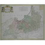
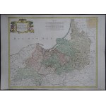
Map of Prussia "Karte von dem Koenigreiche Preussen nach Suchodolez und Endersch neu verzeichnet herausgegeben von Franz Joh. Jos. von Reilly"
Map of the lands of the Republic of Poland Poland, Lithuania, Belarus, Ukraine "KARTE VON POLEN NACH SOTZMANN Neu verzeichnet hearusgegeben von FRANZ JOH. JOS. VON REILLY" bottom left" Zu finden im Reilly'schen Landkarten und Kunstwerke Verschleiss Komptoir Wien 1796", right sheet number "XXIV" Franz Johann Joseph von Reilly, eng. Anton Amon, Vienna 1796 sheet approx. 73.5 by 62 cm
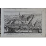
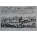
Cistercian monastery in Lubiaz "Prospectus Lubensis Coenoby Principalis Sacr. ac Exemt. Ord. Cisterciensis, in Silesia inferiore" Friedrich Bernhard Werner, pub. Johann Georg Merz ca. 1738 sheet approx. 34.5 by 22 cm
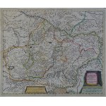
Map of Transylvania (Transylvania) "Nova Transilvaniae Principatus Tabula...". Danckerts, ca. 1690 sheet approx. 62 by 54 cm
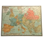
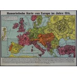
sheet approx. 49.5 by 36 cm map originally folded "Humoristische Karte von Europa im Jahre 1914".
Communication map of Galicia and Bukovina - S. Kornman, published by the H. Altenberg Bookstore in Lviv in 1911, from the cartographic establishment of G. Freytag & Berndt, format 83x53 cm condition: map reinforced - glued on the back, rubbing in places, especially on the bends of the map, left edge frayed, on the back stains and library stamps211127
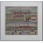
Königsberg and Riga "Die Furstliche Hauptt Statt Konigssbergk in Preussen. Mons Regius..." "Riga, Percommode ad Duna Amnem Sita, Emporium Celebre, et Livoniae Metropolis..." Georg Braun, Fran Hogenberg "CIVITATES ORBIS TERRARUM" Cologne 1581 sheet approx. 52 by 41.5 cm in passe-partout 55 by 51 cm paper slightly soiled (mainly margins), beautiful original coloring
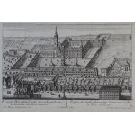
Cistercian Monastery of Henryków "Prospectus Henrichovy Coenoby Sacr. ac Exemt. Ordinis Cisterciensis, in Silesia superiore..." Friedrich Bernhard Werner, pub. Johann Georg Merz ca. 1738 sheet approx. 34.5 by 22 cm
Cistercian monastery in Lubiaz "Prospectus exterior Lubensis Coenoby Principalis Sacr. ac Exemt. Ordinis Cisterciensis, in Silesia inferiore". Friedrich Bernhard Werner, pub. Johann Georg Merz ca. 1738 sheet approx. 34.5 by 22 cm
Map of the southern sky with marked comet transits observed between 1530 and 1740 "Motus Cometarum in Hemisphaerio Boreali". Johann Gabriel Doppelmayr, published by Homann 1742 paper with clear traces of age
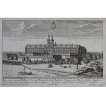
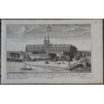
Cistercian monastery in Kamieniec "Prospectus Camencensis Coenoby Principalis Sacr. ac Exemt. Cisterciensis Ordinis, in Silesia superiore". Friedrich Bernhard Werner, pub. Johann Georg Merz ca. 1738 sheet approx. 34.5 by 22 cm
Folding map, in a case ca. 98 by 99 cm, on verso underlining "Théâtre de la guerre ou carte generale comprenant la Prusse, le Grand Duche de Warsowia, l'Autriche, la Turquie et la Russie d'Europe. S'etendant deeuis la Mer Caspienne a l'est, jusqui in Trieste en Istrie a l'Ouest. An Sud depuis l'Isle de Rhodes dans la mer mediterranee jasqu'a St. Petersbourg, au nord.A Paris, Chez l'Auteur, 1...
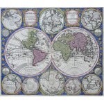
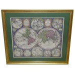
World Map "Diversi Globi Terr-Aquei Statione Variante Et Visu Intercedente Per Coluros Tropicorum, Per Ambos Polos Et Partciul Sphaerae Zenith In Planum Delineati Orthogranici Prospectus". "Quibus addite pro multatione Horizontis differentes Sphaerae Positiones earumque Convenientia et Relatio; Auguste Vindel, Cura et Studio; Math. Seitter, S.C. Maj. Geographi" Matthäus Seutter, Augsburg 1730...
Cistercian monastery in Henryków "Prospectus exterior Henrichovy Coenoby Sacr. ac Exemt. Ordinis Cisterciensis, in Silesia superiore..." Friedrich Bernhard Werner, pub. Johann Georg Merz ca. 1738 sheet approx. 34.5 by 22 cm
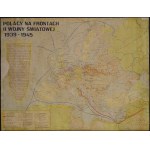
Poles on the fronts of World War II 1939-1945, Filochowska 1971 ca. 65 by 50 cm stains, restored paper loss (left of center, upper right corner)
(POLAND). "Estats de Pologne et de Lithuanie...". Copperplate color. Derived from: Brion M.- Atlas Général, Civil, Ecclésiastique et Militaire...". Paris 1786. Dimensions: 27.5 x 30.5 cm (board: 29.5 x 37.5 cm).Author: Louis Brion de la Tour - French geographer and demographer, bearing the title Ingénieur-Géographe du Roi (engineer-geographer of the King of France). He depicts the territo...
Map of East Prussia "Borussiae Regnum sub fortissimo Tutamine et justissimo Regimine Serenissimi ac Potentissimi Principus Frederici Wilhelmi". Matthaus Seutter, ca. 1740 sheet approx. 64 by 54.5 cm
WroclawCity Hall and the southern part of the Market Square"LA SECONDE PARTIE DE LA PLACE DU MARCHE A BRESLAU"(title at top in mirror image)below"Vue de la seconde partie de la place du marche a Breslau""Fori coquini pars altera Vratislaviae""Vista della seconda parte del Mercato a Breslavia""Prospect der zweyten Seite des Rings oder Marckt Platz zu Breslau".Friedrich Bernhard Werner, Georg Ba...
Salvatore Cardelli, The Burning of Moscow in 1812 "Пожаръ Мockoвckoй" "L'incendie de Moscva".
951 EUR
The Great Fire of Moscow in 1812 during the occupation of Moscow by French troops "Пожаръ Мockoвckoй" "L'incendie de Moscva" Salvatore Cardelli (based on the work of Rugendas) ca. 1813-1819 (the Hermitage dates its piece to 1812-1825). sheet approx. 60.5 by 47.5 cm (sides and bottom trimmed just beyond the borders of the plate print, top before) a few repaired tears (mainly in the upp...
sheet approx. 62 by 54 cm
The siege of Gdansk in 1813 manuscript plan of the siege of Danzig in 1813 on the plan marked fortifications of Danzig and its surroundings, positions of the armies of Loewis, Turchaninov and Treskin (?) descriptions on the plan in German, scale in fathoms ("Faden") ink drawing, lack of title and author's mark - the materials used and their state of preservation indicate without a doubt that t...
Szczecin "Vue d'Optique Representant les Environs du Marche aux Chevaux de Stetin en Allemagne". fanciful view of a section of the city (horse market) Basset (Paul Andre ?), Paris ca. 1780 framed approx. 59 by 47 cm
Cistercian monastery in Camencensk "Prospectus exterior Camencensis Coenoby Sacr. ac Exemt. Cisterciensis Ordinis, in Silesia superiore". Friedrich Bernhard Werner, pub. Johann Georg Merz ca. 1738 sheet approx. 34.5 by 22 cm
Wroclaw City Hall and the southern part of the Market Square "LA SECONDE PARTIE DE LA PLACE DU MARCHE A BRESLAU" (title at top in mirror image) below "Vue de la seconde partie de la place du marche a Breslau" "Fori coquini pars altera Vratislaviae" "Vista della seconda parte del Mercato a Breslavia" "Prospect der zweyten Seite des Rings oder Marckt Platz zu Breslau". Friedrich Bernhard Werner,...
